11 Top-Rated Things to Do in Yoho National Park
Yoho National Park has magnificent mountain scenery and is one of Canada's most spectacular national parks.
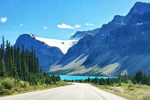
This UNESCO World Heritage Site encompasses snow-covered peaks, beautiful lakes, thundering rivers, distant glaciers, and massive waterfalls. Sightseeing and hiking are the most popular things to do in Yoho.
The park extends over a portion of the Rocky Mountains, adjoining both Banff and Kootenay National Parks. The two main areas of interest are the Yoho Valley and the Kicking Horse River area. The Trans-Canada Highway passes through the park, making access easy.
To help plan your trip, see our list of the things to do in Yoho National Park.
- 1. Visit Lake O'Hara
- 2. Hike at Lake O'Hara
- 3. See Takakkaw Falls
- 4. Spend Time at Emerald Lake
- 5. Stop at Natural Bridge
- 6. Take a Guided Hike to Burgess Shale Fossil Beds
- 7. See Kicking Horse Pass National Historic Site & the Spiral Tunnels
- 8. Hike to Wapta Falls
- 9. Camp at Lake O'Hara
- 10. Camp in Yoho National Park
- 11. White Water Rafting on the Kicking Horse River
- Map of Things to Do in Yoho National Park
1. Visit Lake O'Hara
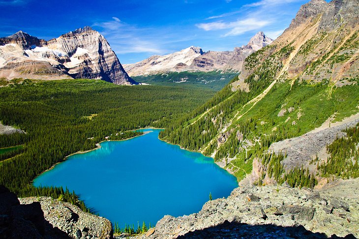
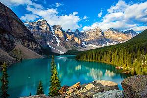
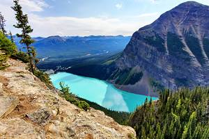
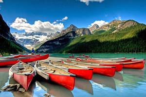
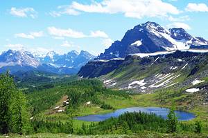
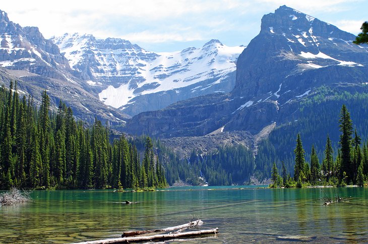
The turquoise-colored Lake O'Hara is considered by many as the most stunning sight in Yoho National Park. The soaring mountains surrounding the lake are home to incredible hiking trails. These scenic trails lead high above the lake, past smaller bodies of water and waterfalls.
A daily bus services the lake, but there is a quota limiting the number of passengers allowed into the area each day. Advance reservations are required and are done on a lottery system.
You can also choose to walk the 13-kilometer road into the lake, and there is no limit on access for those approaching by foot. You'll need to be a hardy soul to choose this option, as before you even start any of the spectacular hikes at the lake, you'll have already walked 13 kilometers and will need to hike another 13 on your way out. Count on a 35-kilometer day at a minimum and although the elevation gain is not huge, it's still a very big day. Biking along the road is not allowed.
On the shore of the lake is the beautiful Lake O'Hara Lodge; just back in the woods is a small park campground. Reservations for both should be made online well in advance, generally a year from the time of arrival. A campground reservation includes bus transportation.
Official site: http://www.pc.gc.ca/eng/pn-np/bc/yoho/index.aspx
2. Hike at Lake O'Hara
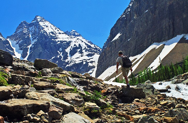
The most popular thing to do at Lake O'Hara is hiking. Although accessing the lake requires some planning, it's well worth it for hikers looking for stunning scenery.
Trails range from a simple 2.8-kilometer trail around the shoreline of the lake to alpine routes that require more skill and a full day to hike.
Some of the most popular routes include the Lake Oesa Trail, Opabin Plateau Circuit, MacArthur Pass, and the Linda Lake Circuit and Morning Glory Lakes, all of which are moderate to easy hikes.
Highlights of hiking in this area include waterfalls, upper alpine lakes, and a great sense of solitude due to the restricted number of visitors allowed at Lake O'Hara. Trails are sometimes closed due to grizzly bears in the area or other hazards.
3. See Takakkaw Falls
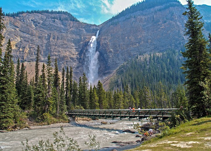
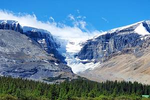
Takakkaw Falls is one of the highest falls in North America, plunging a dramatic 254 meters over a rock face. You can stand near the base of the falls and look straight up, feeling the mist from the spray as it hits the bottom. The waterfall is fed by the Daly Glacier, part of the Waputik Icefield.
Takakkaw Falls can be reached by taking the twisty Yoho Valley Road off the TransCanada up to the parking lot near the base of the falls. Motorhomes over a certain length are not allowed due to the tight switchbacks.
The views, even from the parking lot, are spectacular, but you can easily walk up to the stream along the level trail at the base for a full view of the water falling from above.
Alternatively, for a higher perspective, the Iceline hiking trail leads up the mountainside opposite the falls. Here, you'll be treated to a spectacular view over the falls and beyond to the glacier. This is a moderately strenuous day hike, but well worth the effort for the view and is considered one of the best hikes in Banff National Park.
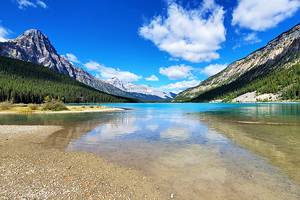
4. Spend Time at Emerald Lake
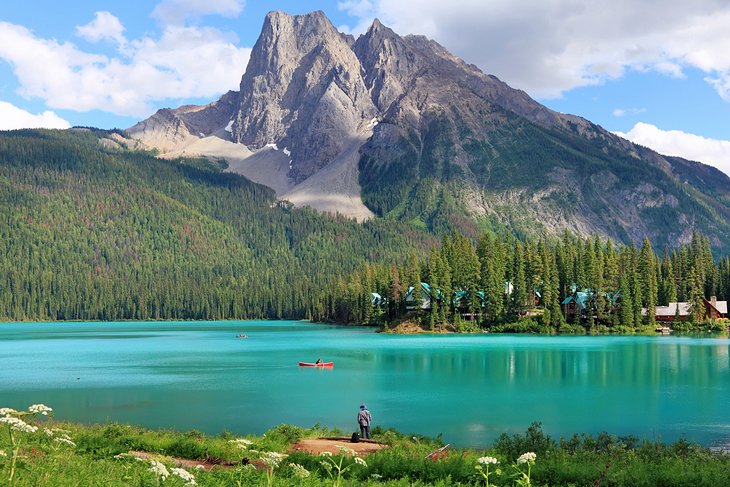
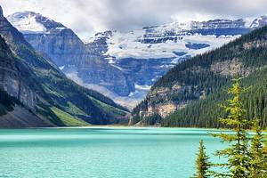
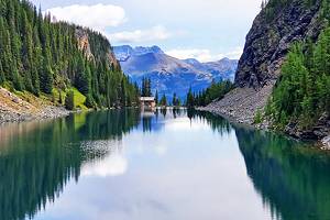
Emerald Lake is, as the name suggests, a beautiful emerald color mountain lake at the foot of the glacier-capped mountains of the President Range. A lovely resort lies along the shoreline with a restaurant that is open to guests and visitors.
Several splendid hikes begin at Emerald Lake, among the most attractive being the Lake Circuit, the climbs to Yoho and Burgess passes, and the Hamilton Lake trail.
Emerald Lake can be reached by taking an eight-kilometer-long road that begins about two kilometers south of the town of Field.
5. Stop at Natural Bridge
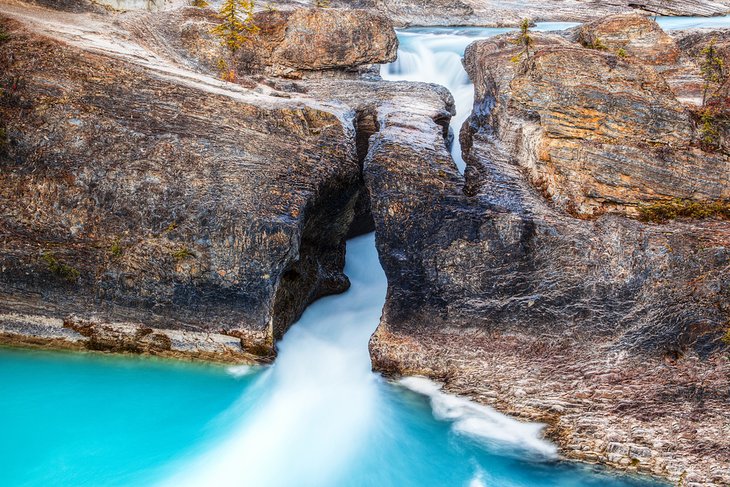
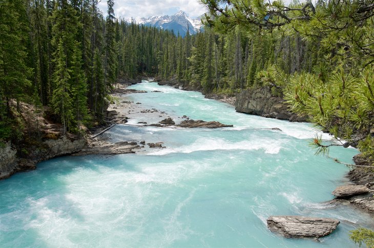
A little way along the road to Emerald Lake is a remarkable natural bridge, beneath which the Kicking Horse River squeezes through extremely resistant rock. The natural bridge is easily accessible and not far from the parking lot. A lookout point is located close to the natural bridge, be sure to walk out to see the blue waters roar through the gap.
If you are looking for a good photo, take the shot straight on from the lookout at the base of the natural bridge. Consider a long exposure to get the water "smeared" in a fan-like look as it emerges from the narrow chasm.
The turn off to the Natural Bridge is easy to miss, keep a look out for it on the left-hand side as you drive into Emerald Lake.
6. Take a Guided Hike to Burgess Shale Fossil Beds
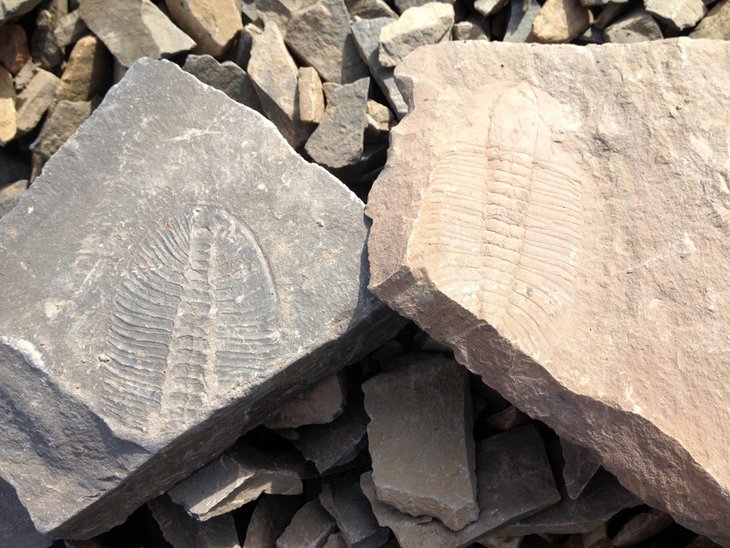
The Burgess Shale Fossil Beds to the east of Field have proved to be extremely important in the field of paleontology. Fossils more than 530 million years old (Cambrian; especially trilobites) recovered from these unique, undisturbed beds have yielded major insights into the development of life on earth.
The Burgess Shale Fossil Beds were discovered by Charles Walcott in 1909 and are today a UNESCO World Heritage Site. The fossil beds reveal a time period when this area was near the equator.
You can only access the Burgess Shale Fossil Beds as part of a guided hike. These are physically demanding hikes with significant distances covered and moderate elevation gain. Hikes last from 7.5 to 11 hours. Check at the Yoho National Park office for information on daily guided hikes and times.
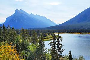
7. See Kicking Horse Pass National Historic Site & the Spiral Tunnels
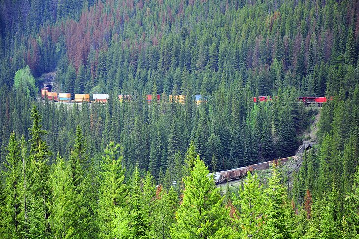
Kicking Horse Pass crosses over the continental divide and is known for the Spiral Tunnels created for the Canadian Pacific Railway Line.
The original line went over what was called "The Big Hill" and was at one time known to have the steepest gradient of any rail line in North America. As a result, accidents were a problem. Eventually spiral tunnels were created to decrease the gradient. There are plaques along the highway discussing the engineering involved in the process of building the railway.
An observation area about nine kilometers west of the 1,625-meter summit of Kicking Horse Pass provides a good view across to the Lower Spiral Tunnel. This daringly engineered section of track with its two spiral tunnels was modeled on the St. Gotthard rail tunnels in Switzerland.
The old bridge on the "Big Hill" was once part of the original CPR track over Kicking Horse Pass. Today, the bridge is simply a tourist attraction. The climb up to Kicking Horse Pass from the east begins at the border between the two provinces of Alberta and British Columbia.
For more railway history, take the easy 1.2-kilometer hike called Walk in the Past. It takes you to an abandoned locomotive set on an old spur line. The trailhead is near the back of the Kicking Horse Campground.
8. Hike to Wapta Falls
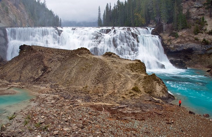
Before the western entrance to Yoho National Park, a side road branches off, ending after five kilometers at a dead-end. From here, a trail leads to the beautiful and roaring Wapta Falls, where the Kicking Horse River cascades down 30 meters over a wide rock step. Wapta Falls is the largest waterfall on the Kicking Horse River.
The falls are reached via a 4.6-kilometer return trail through dense forest. Count on about 1.5 hours of hiking time along a relatively straight path.
9. Camp at Lake O'Hara
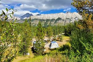
The small campground at Lake O'Hara is nestled on the valley floor, surrounded by towering mountains on three sides. You have to plan well in advance and have a bit of luck on your side to snag one of these 30 sites. The season is short: late June to the 1st week of October.
The campground is ideally situated a short stroll from Lake O'Hara. Once the day trippers head back, the sense of serenity that descends on this magical place is hard to describe. Walk to the shoreline and watch the mountains change color as the sun rises.
Camping here is really the only way to fully experience the spectacular hiking in the mountains around the lake at a leisurely pace. Unlike the day trippers, you won't need to rush back to catch your bus out.
The campsites can be booked in late January either via phone or online. The sites are usually booked within the first few hours, so mark the date on your calendar and get online right away. The booking address is: https://reservation.pc.gc.ca/
10. Camp in Yoho National Park
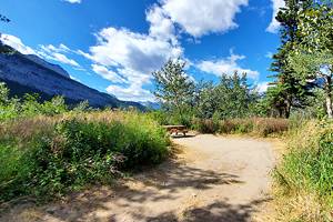
Camping in Yoho National Park is spectacular. About 162 front country drive-to sites are spread out across four campgrounds. In addition, 35 walk-to sites are available. The camping season generally runs from mid May to mid October.
The four main campgrounds are: Kicking Horse, Monarch, Hoodoo Creek, and Takakkaw Falls walk-in. Of these four, only Kicking Horse is reservable; the other three are on a first-come, first-served basis. All campgrounds are unserviced (no water/electricity), Kicking Horse is the only site that has flush toilets and hot showers.
11. White Water Rafting on the Kicking Horse River
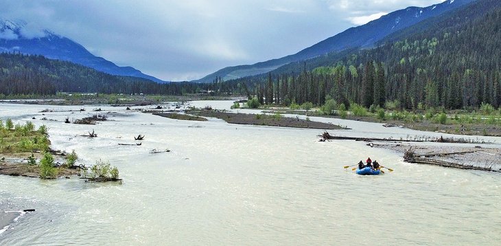
The uniquely named Kicking Horse River provides a thrill a minute ride for those looking to do a bit of white water rafting in Yoho National Park. Fun, but not overwhelming, white water rafting here is suitable for all ages and is especially family-friendly. Rapids range from level II through to IV plus, getting more intense as the season progresses.
Rafts range in size from 14 feet to 16 feet.
Raft trips run from late July until the end of August, and the glacier-fed water is cold. You'll be provided with a full wetsuit and all the safety gear. All you need to do is bring a sense of adventure.