20 Top-Rated Tourist Attractions in British Columbia
British Columbia's mountains, lakes, islands, rainforests, beautiful stretches of coastline, picturesque cities, attractive towns, and world-class skiing make it one of the most popular destinations in Canada.
Most visitors to BC begin in Vancouver, which makes a great starting point for touring the province. A short flight or ferry trip from here will take you to Vancouver Island and the provincial capital, Victoria. Less than a two-hour drive from Vancouver is the resort town and ski destination of Whistler. In the interior of BC, the Okanagan Valley is another year-round hot spot, with the beaches on the shores of Okanagan Lake, golf courses, and numerous ski resorts.
For a more complete overview and to help plan your itinerary, see our list of the top tourist attractions in British Columbia.
- 1. Whistler
- 2. Vancouver Island
- 3. Okanagan Valley & Kelowna
- 4. Tofino and Pacific Rim National Park Reserve
- 5. Vancouver and Stanley Park
- 6. Victoria & the Inner Harbour
- 7. Yoho National Park
- 8. Old-Growth Forests
- 9. Butchart Gardens
- 10. Haida Gwaii
- 11. Glacier National Park
- 12. Salt Spring Island
- 13. Kootenay National Park
- 14. Nelson
- 15. Emerald Lake
- 16. Mt. Robson Provincial Park
- 17. Barkerville Historic Town
- 18. Hell's Gate Airtram in the Fraser Canyon
- 19. Squamish
- 20. Revelstoke
- Map of Tourist Attractions in British Columbia
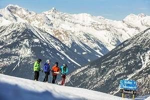
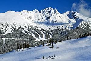
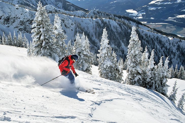
1. Whistler
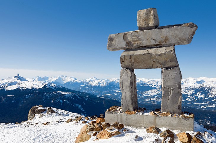
At the foot of the Whistler and Blackcomb Mountains, Whistler is the center of the biggest winter sports area in Canada. In 2010, this world-class ski resort attracted much international attention when it hosted the downhill ski events for the Winter Olympic Games.
While it is closely associated with skiing and snowboarding in Canada, Whistler is a year-round destination with hiking trails, mountain biking trails, golfing, and beautiful scenery to explore in the summer. Visitors don't even need to ski or be active to enjoy this lovely town. One of the main attractions is the Peak 2 Peak Gondola, which joins Whistler and Blackcomb mountains. The distance covered is a record breaking 4.4 kilometers. The ride takes only 11 minutes and offers spectacular views of the area.
Whistler Village is a modern, upscale town with luxury hotels, high-end shopping, and fine dining. Although, you can still find casual restaurants and regular retail and grocery stores.
The town's close proximity to Vancouver, only a two-hour drive from the city, means it is also easily accessible. The drive to Whistler from Vancouver along the Sea-to-Sky Highway is beautiful. Popular stops on this route include the community of Squamish and Shannon Falls.
2. Vancouver Island
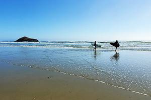
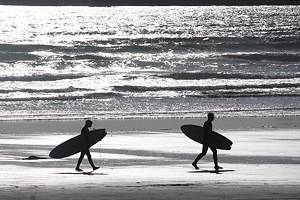
On Canada's far western coast, Vancouver Island is home to some spectacular coastal scenery, mountains, lakes, and other natural attractions, as well as lovely small towns and the provincial capital of Victoria. Coastal beaches provide year-round surfing, particularly near the popular tourist town of Tofino and nearby Pacific Rim National Park.
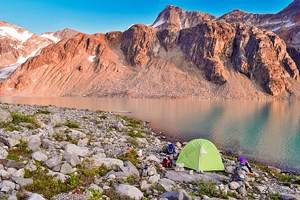
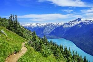
Vancouver Island is the largest island on the Pacific coast of North America. Much of it is very remote with limited access. If you take the time to explore the island, you'll find some incredible hiking trails, including the epic multi-day West Coast Trail, one of the best hikes in Canada. Campers can find a variety of excellent campgrounds spread around the island.
Vancouver Island is located west of the city of Vancouver and reached either by a short flight or a ferry ride. Ferries or flights will take you to the Victoria area or into Nanaimo, another popular town on the Island.
3. Okanagan Valley & Kelowna
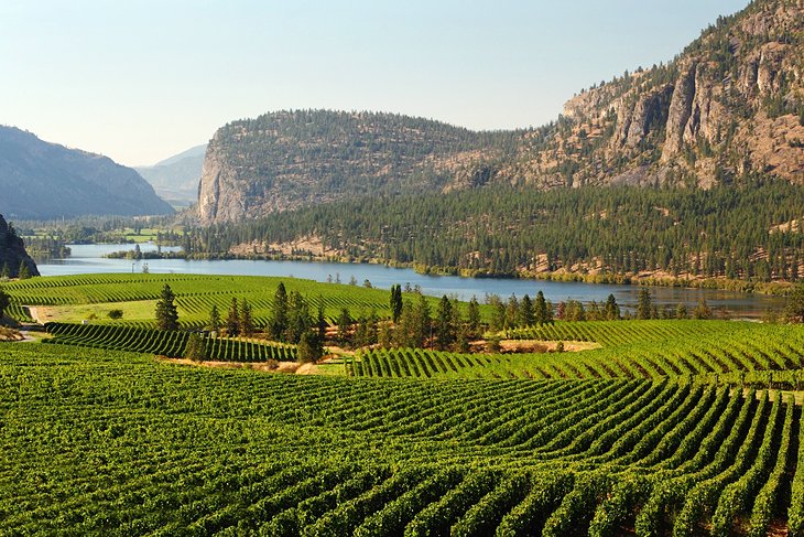
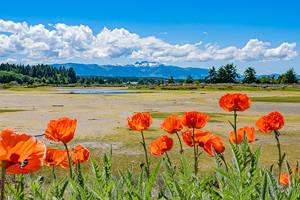
Found in the interior of the BC, the Okanagan Valley, most often referred to simply as the Okanagan, is a lush, sunny valley with lakes, beaches, rolling mountains, and orchards. At the heart of the region is the 120-kilometer-long Okanagan Lake and the city of Kelowna on the eastern shore of the lake. Other popular towns in the area include Summerland, Peachland, Penticton, and Vernon.
The Okanagan has hot dry summers and mild winters making it a popular retirement destination and a prominent summertime retreat for people from across British Columbia and neighboring Alberta. Some of the most common summertime activities are houseboating, golfing, and spending time at the beach.
In winter, many people come here to enjoy some of the best ski resorts in British Columbia, including Big White Ski Resort and SilverStar Mountain Resort.
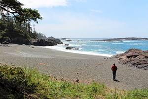
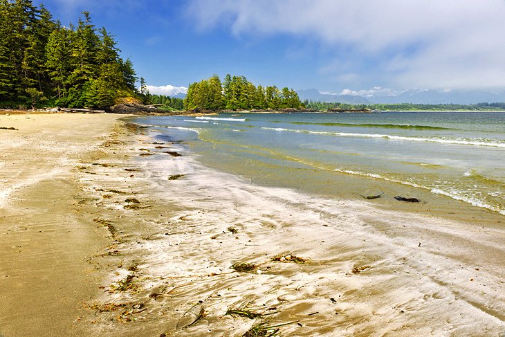
4. Tofino and Pacific Rim National Park Reserve
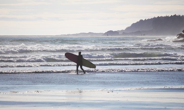
This tiny tourist town on the edge of Pacific Rim National Park Reserve is the perfect place for nature lovers looking for a coastal retreat. Endless stretches of beach attract surfers year-round, but most people come here simply to stare out at the waves, storm watch in the off season, or walk for miles on the hard-packed sand.
Off the beach, visitors can hike through old-growth forests or camp along the oceanfront in some of the most stunning coastal scenery in British Columbia.
Couples often come here for a romantic getaway and to relax at one of the luxury seaside resorts and charming lodges. A variety of tours are also offered in the area, from kayaking on Clayoquot Sound to whale watching.
Tofino has an extremely remote feel to it, but it's relatively easy to access from places like Victoria or Nanaimo. Nearby, Ucluelet is another small town that makes a nice day trip from Tofino.
- Read More: Top Things to Do in Tofino
5. Vancouver and Stanley Park
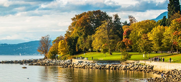
Stanley Park is one of the great features of Vancouver that sets it apart from other major cities across Canada. This huge green space on the edge of the downtown core offers a beautiful nature retreat for visitors and locals.
The park is home to ancient cedars and huge Douglas fir trees. The seawall is one of the main attractions, offering miles of scenic paved path for walking, jogging, or biking. Trails also run through the forest. Within the park is the Vancouver Aquarium, as well as various other attractions, including totem poles, gardens, and beaches.
Read More:
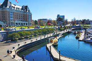
6. Victoria & the Inner Harbour
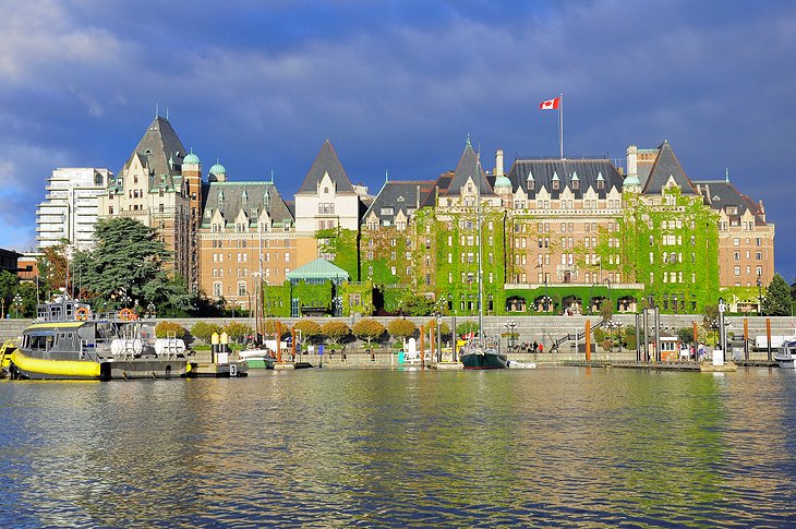
Located on Vancouver Island, Victoria is the capital of British Columbia and one of Canada's most scenic cities. Removed from the mainland, this city has the feel of a small town, but is home to a wealth of attractions and things to do. The city is considered by many locals and tourists alike to be one of the best places to visit in BC.
You'll find a mix of people living here, from retirees fleeing the cold in one of Canada's warmest cities to young tech workers and a large segment of the population working for the provincial government. Somehow it all works, and the people of Victoria tend to be relaxed and friendly, always happy to point you in the right direction should you get lost.
At the heart of the city for both locals and tourists is the Inner Harbour, dominated by the grand Empress Hotel, built in 1908 for the Canadian Pacific Railway. This area is always alive with visitors and locals enjoying the waterfront, particularly in the summer when restaurants open their patios for outdoor dining and street performers take to the sidewalks.
If you are looking for things to do, take in the incredible mountain and ocean views from hiking trails in and around Victoria. For something a little less strenuous, consider High Tea at the Empress Hotel or wander by the Parliament Buildings.
Read More: Best Campgrounds near Victoria
7. Yoho National Park
Yoho National Park is home to some of British Columbia's most rugged and scenic mountain terrain. Snowcapped peaks, waterfalls, rivers, and crystal-clear lakes, including spectacular Lake O'Hara, draw large numbers of visitors to this park during the summer months.
Incredible hiking trails allow easy access to the backcountry, but even a drive through the park offers enough exposure to appreciate the landscape. If you are touring Yoho National Park by car, one of the highlights is Takakkaw Falls, one of the highest falls in North America.
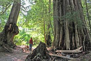
8. Old-Growth Forests
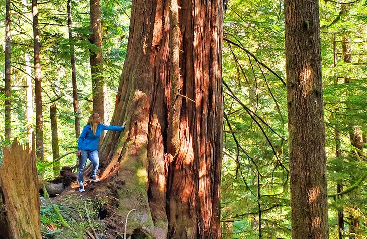
BC has some of the world's most intact old-growth forests, these giant trees have stood as sentinels over the millennia. A visit to one of the stands of trees is a humbling experience that makes you feel small and insignificant.
The old-growth stands are located around the province, but the most accessible locations are on Vancouver Island. The most popular and easiest place to see the trees is at Cathedral Grove on Highway 4 between Qualicum, near Parksville, and Port Alberni. Here, you'll find walkways throughout the giant trees along with informational exhibits.
Another great spot to see the old growth trees is in the Pacific Rim National Park near Tofino. Excellent trails with raised boardwalks wind their way through the trees, up and down small valleys and over burbling brooks.
If you truly want to see the trees in their natural environment and have a sense of adventure, head to the logging roads north of Sooke in the small town of Port Renfrew. Up here are groves of majestic trees, some of which are threatened by logging. The main groves are Avatar Grove and Eden Grove. You'll find short walks through the forest along some stretches of boardwalk in both areas.
You'll need a high clearance vehicle to see the ones at Eden Grove, as the road gets very rough at one point. Most people drive to this point and walk along the road to the grove. Of all the groves in BC, this is the one most in danger of being cut down. See it before it's gone.
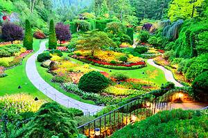
9. Butchart Gardens
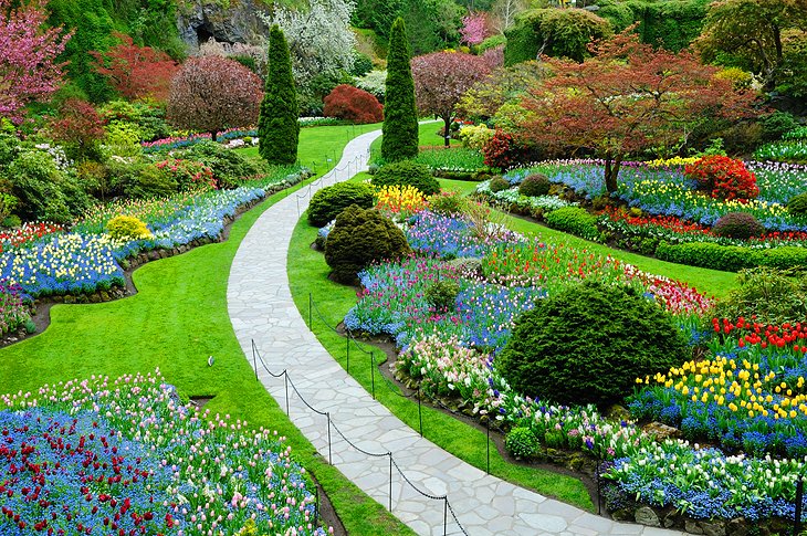
Set in an old quarry, Butchart Gardens offers a fabulous display of plants, trees, and flowers. Located just outside Victoria, the mild climate is perfect for changing seasonal displays. Spring through fall is outstanding, when the spring blooms come out and the fabulous display of summer color peaks.
Fall brings the changing leaves of autumn and a burst of color from a wide variety of trees and blooming plants. Extensive walkways wind their way around themed gardens and water features over the 20-hectare property.
Official site: https://www.butchartgardens.com/
10. Haida Gwaii
Haida Gwaii is one of Canada's undiscovered treasures. These remote islands provide a wealth of culture and natural beauty, but are often overlooked by tourists. Formerly known as the Queen Charlotte Islands, Haida Gwaii is an isolated group of more than 150 islands in the Pacific Ocean at the western edge of the continental shelf. The two main islands, Graham and Moresby, are located about 50 kilometers and 150 kilometers respectively off the coast of British Columbia.
The native inhabitants, the Haida people, are thought to have lived on these islands for at least 8,000 years. They were known as proud warriors and daring navigators. With their awesome 20 meter-long war canoes, they traversed the length of the Inside Passage as far south as Puget Sound.
Today, they are more famous for the skill and artistry of their carving. Their totem poles and elaborate argillite carvings can be found in every ethnographic museum on the Canadian Pacific coast.
11. Glacier National Park
Glacier National Park, along with Mount Revelstoke National Park a few miles further west, is a scenic area and a favorite with climbers and hikers. The parks lie in one of Canada's most inhospitable mountainous regions, the almost inaccessible northern Selkirk Range of the Columbia Mountains.
The landscape is one of jagged peaks, steep descents, and narrow valleys cut deep into the rock. There are approximately 400 glaciers in and around Glacier National Park. At lower levels, up to about 1,300 meters, the dense forests are home to some enormous old trees - western red cedars, hemlocks, and firs - as well as a ground cover of ferns. Mountain goat, woodland caribou, black bears, and grizzly bears are some of the wildlife that can be found in the park.
Most visitors simply drive through, but there are numerous hiking trails and camping facilities. Rogers Pass National Historic Site is also located within Glacier National Park.
Official site: https://www.pc.gc.ca/en/pn-np/bc/glacier
12. Salt Spring Island
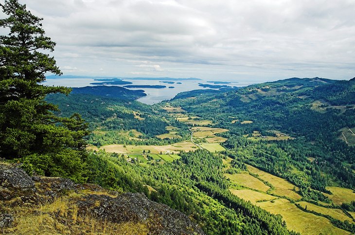
In the Gulf Islands between Victoria and Nanaimo, Salt Spring Island has a small population and is known for its laid-back Bohemian lifestyle. Around this scenic island are artists' studios and farms selling cheese and homemade products. Funky shops sell clothes and trinkets you might expect to find in Southeast Asia.
The main town on the island is Ganges, where visitors will find ice cream shops, cafes and restaurants, and more traditional retail establishments and souvenirs. There is a provincial park on the oceanfront with walking trails, camping facilities, and day use areas. The island also offers inns and other accommodation options.
Ferries run from Tsawwassen on the mainland (Vancouver), Swartz Bay (Victoria), or Crofton (Nanaimo).
13. Kootenay National Park
Kootenay National Park, in southeastern British Columbia, adjoins Banff National Park and Yoho National Park, and takes in the magnificent western flank of the Canadian Rockies. The main mountain range in Kootenay National Park reaches heights of over 3,000 meters, and the landscape features rugged rocky ridges and sawtooth peaks, snow and ice-covered mountains, cirques, glaciers, hanging valleys, and narrow gorges cut deep into marbled limestone.
Numerous day hikes in the park pass some of these unique sites and natural features. Key highlights in Kootenay are the narrow gorge of Marble Canyon, hiking around Sinclair Pass, and Stanley Glacier.
Official site: https://www.pc.gc.ca/en/pn-np/bc/kootenay
14. Nelson
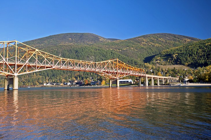
Nelson lies in a beautiful spot on the western arm of Kootenay Lake, surrounded by the snow and ice-covered peaks of the Selkirk Mountains. This former mining town grew up at the end of the 19th century and quickly developed into a tourist center and one of the best cities in British Columbia. The town still has many carefully preserved Victorian buildings, which give it a charm all of its own. Nelson is also known for attracting artists and young adults interested in alternative lifestyles.
Nearby is the wild country of Kokanee Glacier Provincial Park, containing numerous picturesque mountain lakes. Most of this pristine mountain region lies at a height of more than 2,100 meters above sea-level. Kokanee Peak, at 2,774 meters, towers majestically above the rest of Kokanee Glacier Provincial Park. Also nearby is Kokanee Creek Provincial Park with sandy beaches and campsites.
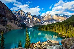
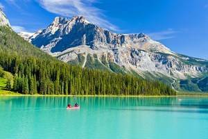
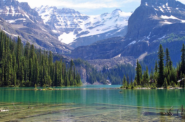
15. Emerald Lake
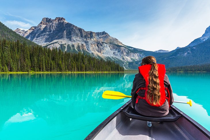
Emerald Lake is one of the most spectacular lakes in the Canadian Rockies. Its green hues and glass-calm waters never fail to win the hearts of the casual visitor and amateur photographers. This lake is near the Alberta border but is considerably less busy than Moraine Lake or Lake Louise, and if you only have time for a quick look and don't want to take shuttles, this is the place to visit.
An easy, level gravel trail runs along one side of the lake for 5.2 kilometers and offers walkers incredible views of the surrounding mountain peaks and glaciers. Another popular pastime here is canoeing on the clear waters of the lake. Rentals are available at the concession stand near the lakeshore.
If you work up an appetite or thirst, stop in at the historic Emerald Lake Lodge. Dine inside the building and admire the architecture dating from 1882, or grab a patio seat and soak up the surroundings. If you want to spend the night here, be sure to book well in advance.
16. Mt. Robson Provincial Park
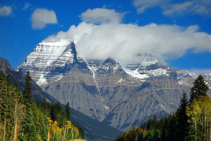
Near the BC-Alberta border, north of Jasper, Mt. Robson Provincial Park is home to Mt. Robson, the highest peak in the Canadian Rockies, at 3,954 meters. The magnificent mountain landscape is dominate glacier-capped peaks and huge waterfalls.
One of the most popular hikes here is the 25-kilometer trail through the "Valley of the Thousand Falls" to the lovely turquoise lake at the foot of Mt. Robson. On rainy days, the name "thousand falls" becomes obvious as the streams of water pour off the cliff walls.
The area was designated a provincial park in 1913. Even in those days, mountaineers and tourists were drawn to the area, undeterred by the distances involved. Today, the remoteness of this park means that it does not see the great numbers of tourists seen by parks to the south.
Official site: http://www.env.gov.bc.ca/bcparks/explore/parkpgs/mt_robson/
17. Barkerville Historic Town
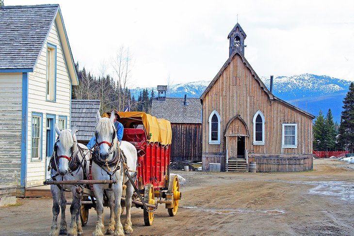
Barkerville Historic Town has an interesting history. In 1858, when news spread that gold had been found in the fluvial sand of the Fraser River, there were soon thousands of men panning for gold all along the river and its tributaries. In the summer of 1862, Billy Barker made his sensational find here at Williams Creek and a typical gold-digging town of simple wooden huts, tents, saloons, and shops sprang up almost overnight. Until it burned down in 1868, Barkerville was the "largest town west of Chicago and north of San Francisco".
Although the town was immediately rebuilt, the end of the gold boom was already apparent. The introduction of machinery meant there was a need for fewer men. Following the end of the gold-rush, Barkerville continued, but was inhabited by settlers and lumberjacks.
Today, visitors will find a restored gold-mining town with about 75 historic buildings making this a fun destination and one of the best places to visit in BC. In summer, costumed interpreters dressed in period costume act out "living history," making it possible to visit a printing-works or smithy, a typical general store, a barber shop, or the "Barkerville Hotel" and feel completely transported back to the times of the gold-rush.
In winter, visitors can participate in snow and cold weather activities, like skating and tubing, or simply enjoy a hot chocolate and some time outdoors.
Official site: http://www.barkerville.ca/
18. Hell's Gate Airtram in the Fraser Canyon
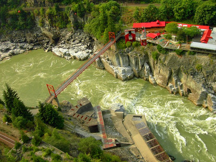
A three-hour drive east of Vancouver is one of Canada's most impressive gorges. Here, the raging torrents of the Fraser River force their way through a narrow pass, known as Hell's Gate, between rocky walls towering almost vertically above the river.
The Hell's Gate Airtram is the best way to view this part of the Fraser Canyon. In days gone by, the Indians found a perilous way across by using ladders. Today, a funicular railway, with impressive views of the wild gorge below, leads down to the lower bank 150 meters below. At the base, are souvenir shops, a restaurant, and a small information center. A climb of a few minutes takes visitors down a reasonable path to the white, foaming river below. The opposite bank can be reached by means of a swaying suspension bridge.
Official site: http://www.hellsgateairtram.com/visit/
19. Squamish
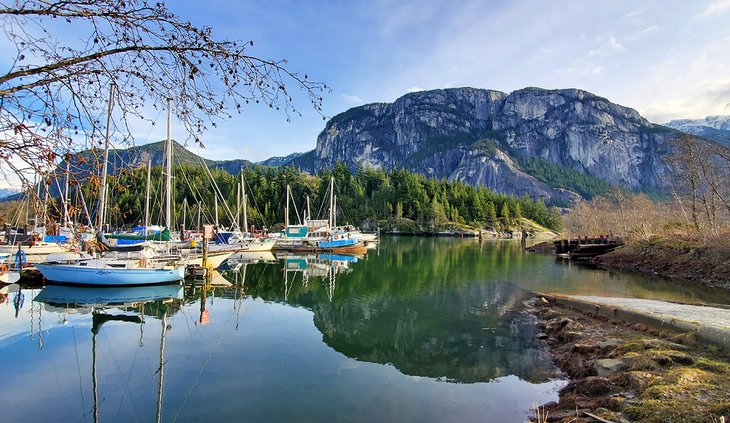
Once a sleepy town with an industrial economy, Squamish today is a fast growing, bustling community. Filled with an eclectic mix of those fleeing Vancouver, longtime locals, and a transient population made up of skiers and climbers, Squamish has a vibe all its own.
The city is located at the far end of Howe Sound and is spread out along Highway 99. Downtown is a collection of interesting and functional stores and, of course, a good number of coffee shops. Although the town is nice, the main draw here is the scenery, with the 700-meter-high Stawamus Chief rock face and Shannon Falls both located nearby.
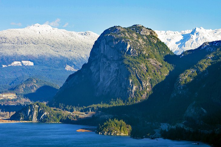
One of the popular things to do when visiting Squamish is to ride the Sea to Sky Gondola. This incredible sightseeing experience allows you to access areas that would normally take long hours, if not days, of hiking to reach. At the top, a suspension bridge extends to a fantastic lookout.
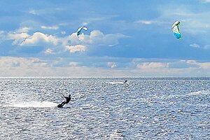
In the summer you used to see kiteboarders and their colorful kites racing across the water. Unfortunately with the closure of the road to the launching site due to environmental concerns, this spectacle is now much, if not completely, diminished.
Read More: Top-Rated Hikes in Squamish, BC
20. Revelstoke
The small town of Revelstoke, more commonly referred to as "Revy," is one of the best places to visit in the interior of BC. Roughly halfway between Banff and Kamloops, Revelstoke is known as one of the premier destinations in Canada, if not the world, for heli-skiing. Towering peaks stuffed with powder snow surround the town, and people come from far and wide to make fresh tracks in the untouched wilderness.
If heli-skiing isn't in your budget, the local ski hill, Revelstoke Mountain Resort, is a good option. The resort gets its fair share of the legendary snow falling on the nearby peaks. The town itself is a decent place to stay, with a cute main street and an excellent railway museum.